Chhattisgarh Land Records Project Bhuiyan by NIC for Khasra Khatauni map details
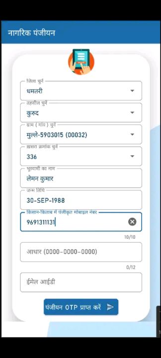
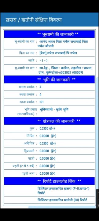
Bhuiyan is the Land Records project of Chhattisgarh developed by National Informatics Centre (NIC), Govt. of India. This mobile application allows Citizen to view the information pertaining to selected land parcel (Khasra) by providing selection parameters viz. District, Tehsil, Village and Khasra number or part of Owner name in Devnagari (UNICODE).
Data safety
Safety starts with understanding how developers
collect and share your data. Data privacy and security practices may vary based
on your use, region, and age. The developer provided this information and may
update it over time.
Whats New
Bug fix related to the QR scanner functionality for B-I and P-II report scanning